Sky Lake Drainage Map, 1973
Dublin Core
Title
Sky Lake Drainage Map, 1973
Alternative Title
Sky Lake Drainage Map
Subject
Orlando (Fla.)
Description
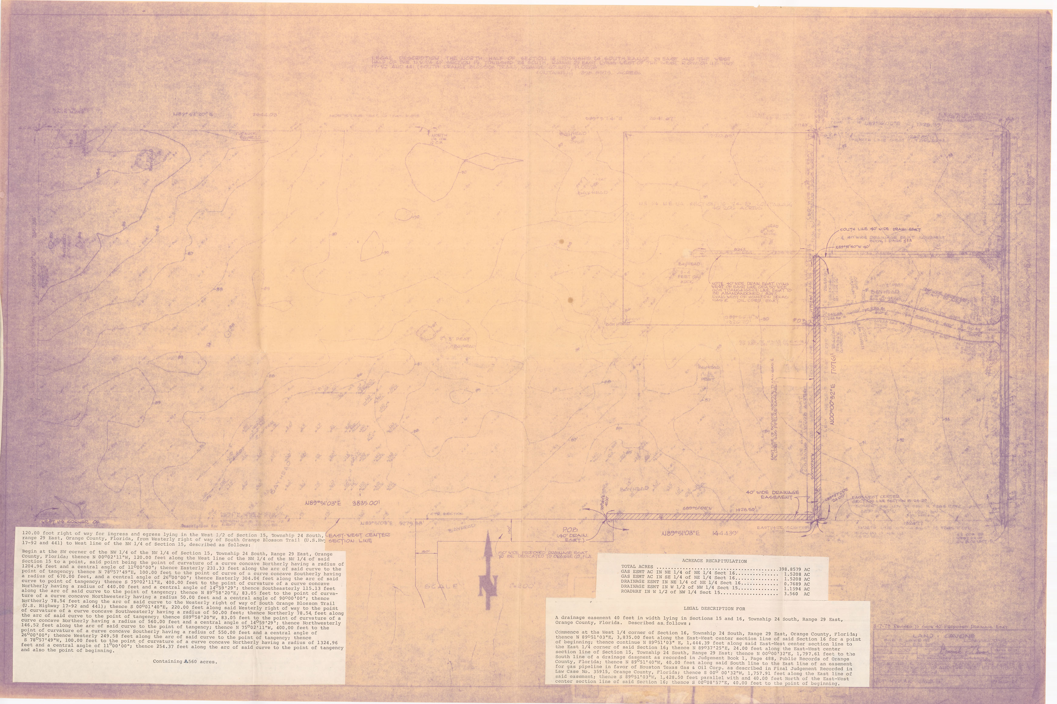
A map showing drainage easements for a portion of Orange County, Florida, describing what is likely the real estate property of present-day Sky Lake. The map was prepared at the request of Hyman Lake, the real estate developer of Sky Lake, a residential community and unincorporated area in Orange County. It is located approximately seven miles south of Downtown Orlando between Lancaster Road and Sand Lake Road. The community was developed in late 1950s and 1960s by Hymen Lake. Houses originally sold in the range of $10,000 to $15,000. In the 1970s, Sky Lake became one of the first housing developments to be racially integrated. The community was originally proposed to include one thousand homes within the middle of the square mile block and a ring of commercial developments along the perimeter.
Source
Original 36 x 24 inch drainage map: Pine Castle Historical Society, Pine Castle, Florida.
Date Created
1973-03
Contributor
Lake, Harriett
Is Format Of
Digital reproduction of original 36 x 24 inch drainage map.
Is Part Of
Sky Lake Collection, Orange County Collection, RICHES of Central Florida.
Format
image/jpg
Extent
1.12 MB
Medium
36 x 24 inch drainage map
Language
eng
Type
Still Image
Coverage
Sky Lake, Florida
Accrual Method
Donation
Mediator
History Teacher
Rights Holder
Copyright to this resource is held by the Pine Castle Historical Society and is provided here by RICHES of Central Florida for educational purposes only.
Curator
Cepero, Laura
Digital Collection
Source Repository
External Reference
Tracy, Jane. "Harriett and Hymen Lake .'" Orlando Memory, March 11, 2014, http://dc.ocls.info/memory/image/harriett-and-hymen-lake.
Collection
Citation
“Sky Lake Drainage Map, 1973,” RICHES, accessed July 30, 2026, https://richesmi.cah.ucf.edu/omeka/items/show/7470.