Woodside Village Plat Map
Dublin Core
Title
Woodside Village Plat Map
Alternative Title
Woodside Village Plat Map
Subject
Orlando (Fla.)
Description
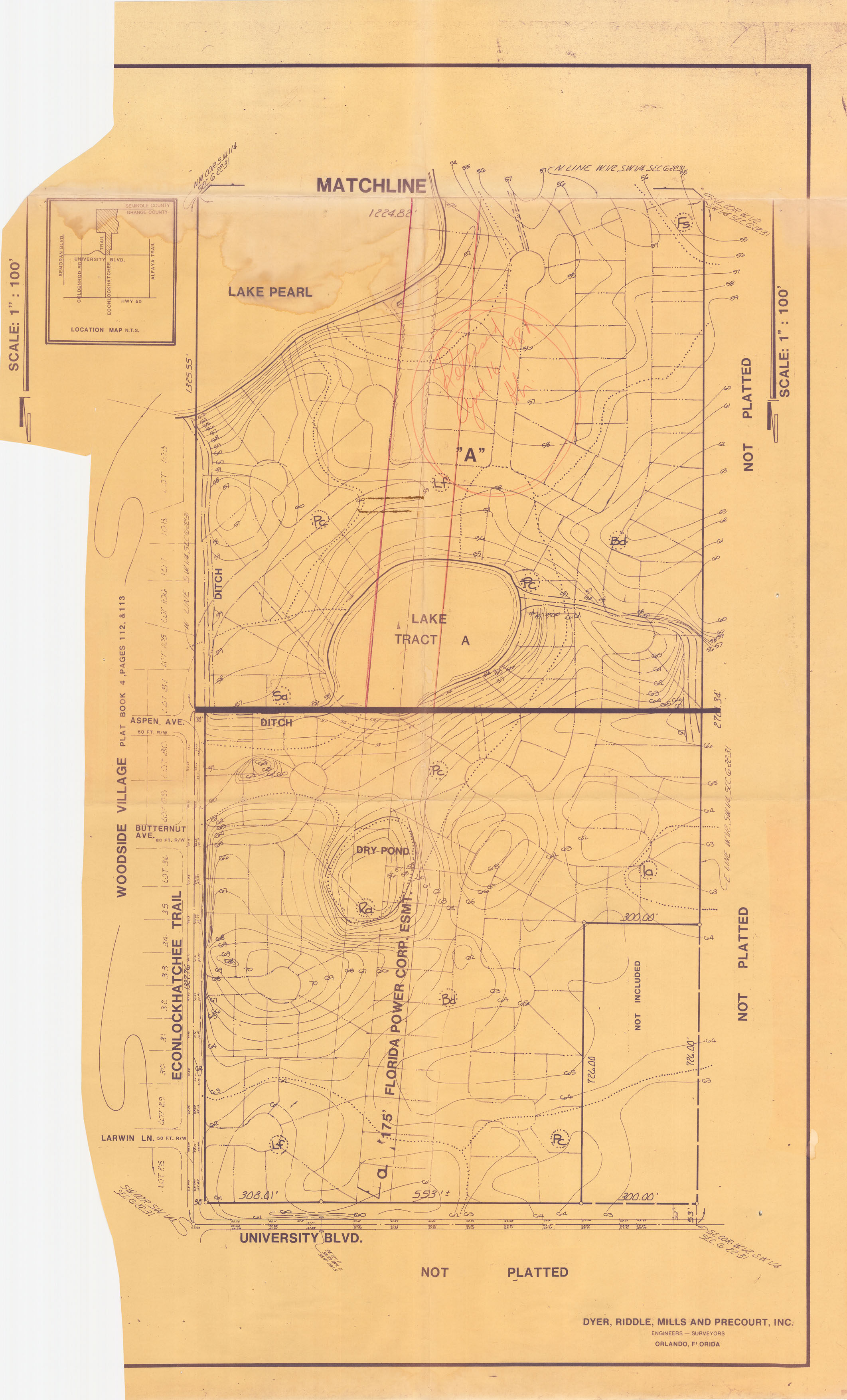
A play map showing Woodside Village, a residential community in Orlando, Florida. This plat shows real property located north of University Boulevard and west of North Econlockhatchee Trail and was prepared by Dyer, Riddle, Mills & Precourt, an Orlando-based engineering firm.
Source
Original 37 x 20 inch plat map: Pine Castle Historical Society, Pine Castle, Florida.
Publisher
Date Created
ca. 1980-1989
Contributor
Lake, Harriett
Is Format Of
Digital reproduction of original 37 x 20 inch plat map.
Is Part Of
Orlando Collection, Orange County Collection, RICHES of Central Florida.
Format
image/jpg
Extent
1.29 MB
Medium
37 x 20 inch plat map
Language
eng
Type
Still Image
Coverage
Woodside Village, Orlando, Florida
Accrual Method
Donation
Mediator
History Teacher
Provenance
Originally published by Dyer, Riddle, Mills and Precourt.
Rights Holder
Copyright to this resource is held by DRMP, Inc. and is provided here by RICHES of Central Florida for educational purposes only.
Curator
Cepero, Laura
Digital Collection
Source Repository
External Reference
"OUR HISTORY." DRMP. http://www.drmp.com/Our_History.html.
Collection
Citation
“Woodside Village Plat Map,” RICHES, accessed July 29, 2026, https://richesmi.cah.ucf.edu/omeka/items/show/7472.