Grid Map of Unincorporated Communities South of Orlando
Dublin Core
Title
Grid Map of Unincorporated Communities South of Orlando
Alternative Title
Pine Castle Grid Map
Subject
Orlando (Fla.)
Pine Castle (Orlando, Fla.)
Edgewood (Fla.)
Taft (Fla.)
Belle Isle (Fla.)
Description
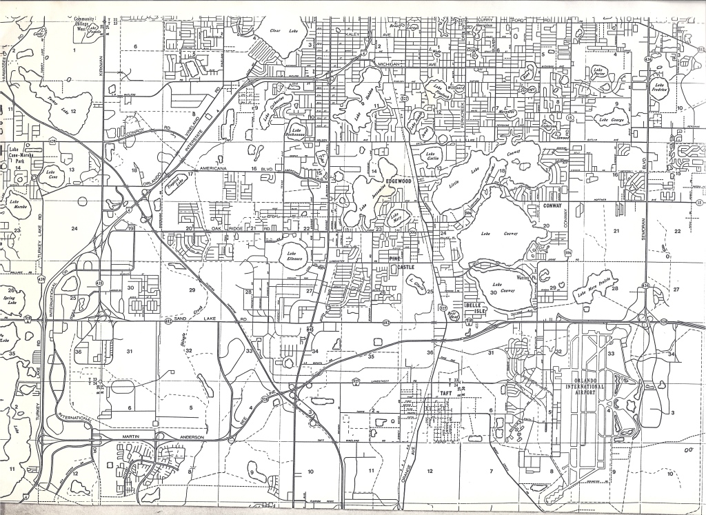
A grid map of various unincorporated communities south of Orlando, Florida. Such communities include Edgewood, Pine Castle, Conway, Belle Isle, and Taft. Other notable sites on the map include the Orlando International Airport and the Martin Andersen Bee Line Expressway, formerly called Florida State Road 528 (SR 528).
Source
Original map: Pine Castle Historical Society, Pine Castle, Florida.
Date Created
ca. 1960-1969
Contributor
Lake, Harriett
Is Format Of
Digital reproduction of original map.
Is Part Of
Orange County Collection, RICHES of Central Florida.
Format
image/jpg
Extent
548 KB
Medium
1 map
Language
eng
Type
Still Image
Coverage
Edgewood, Florida
Pine Castle, Florida
Conway, Florida
Belle Isle, Florida
Taft, Florida
Orlando International Airport, Orlando, Florida
Accrual Method
Donation
Mediator
History Teacher
Geography Teacher
Rights Holder
Copyright to this resource is held by the Pine Castle Historical Society and is provided here by RICHES of Central Florida for educational purposes only.
Curator
Cepero, Laura
Digital Collection
Source Repository
External Reference
Tracy, Jane. "Harriett and Hymen Lake .'" Orlando Memory, March 11, 2014, http://dc.ocls.info/memory/image/harriett-and-hymen-lake.
Collection
Citation
“Grid Map of Unincorporated Communities South of Orlando,” RICHES, accessed July 31, 2026, https://richesmi.cah.ucf.edu/omeka/items/show/7973.