Browse Items (3 total)
Sort by:
Map of Seminole County, Florida, 1928
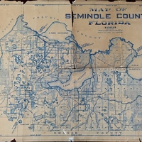
Created in 1928 by Sanford’s city engineer, Fred T. Williams, this surveyor's map depicts Seminole County, Florida. During his tenure as city engineer from the 1920s through the early 1940s, Williams created multiple maps that show how Sanford has…
Map of City of Sanford and Environs, 1926
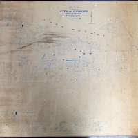
Created in October of 1926 by Sanford’s city engineer, Fred T. Williams, this surveyor's map depicts the City of Sanford, Florida, and its environs. During his tenure as city engineer from the 1920s through the early 1940s, Williams created multiple…
Map of Seminole County, Florida, 1936
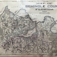
Created in 1936 by Sanford’s city engineer, Fred T. Williams, this surveyor's map depicts Seminole County, Florida. During his tenure as city engineer from the 1920s through the early 1940s, Williams created multiple maps that show how Sanford has…