Browse Items (2 total)
Sort by:
Map of Daytona and Surroundings, 1896
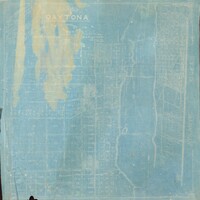
An 1896 map of Daytona and its surroundings in Volusia County, Florida, prepared by D. D. Rogers. The map covers the area from the Atlantic Ocean west to Fifth Street and from Mason Street south to Fremont Avenue. It shows three bridges across the…
Report of Proposed System of Waterworks for the City of Daytona, Florida
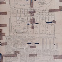
An April 1908 report and map outlining a proposed waterworks system for the City of Daytona, Florida. The mapped distribution system covers the area from Beach Street to Fourth Street and from Fremont Avenue to Arlington Avenue and identifies the…