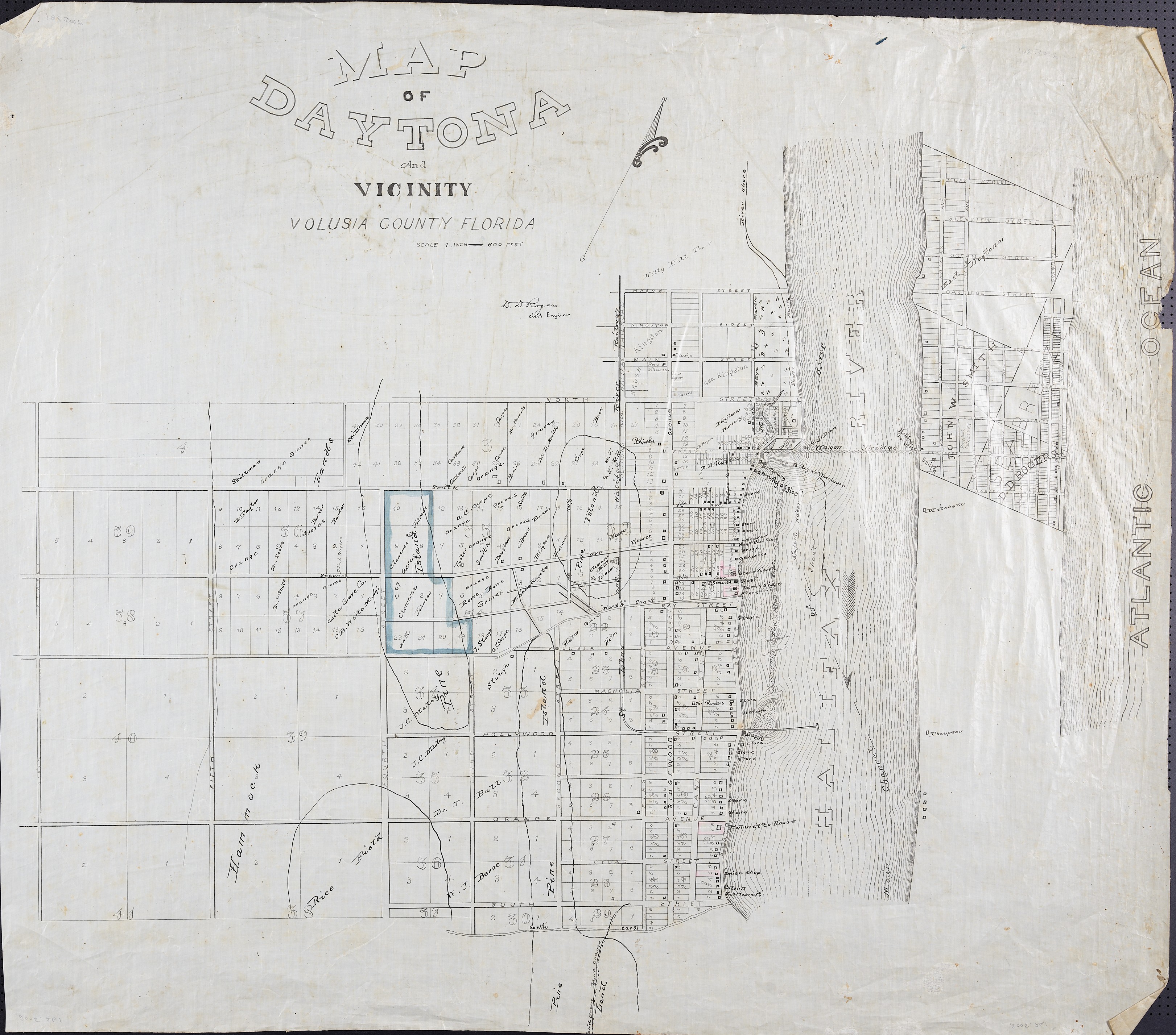
Map of Daytona and Vicinity, Volusia County, Florida
Dublin Core
Title
Map of Daytona and Vicinity, Volusia County, Florida
Alternative Title
Daytona and Vicinity
Subject
Daytona Beach (Fla.)--Maps
Volusia County (Fla.)--Maps
Halifax River (Fla.)--Maps
Description
An undated map of Daytona and vicinity in Volusia County, Florida, prepared by D. D. Rogers. It depicts the Atlantic Ocean and Halifax River and identifies Pinewood Cemetery, a wagon bridge connecting Fairview and Seabreeze avenues, the Halifax Post Office, Palmetto House, depot, ice factory, railway office, mill, Rogers Warehouse, North Canal, South Canal, and a rice field. The mapped street area extends approximately from Sixth Street to Beach Street and Mason Street to South Street. The original is an ink map on linen measuring approximately 34.5 by 30.5 inches.
Creator
Rogers, D. D.
Source
Accession no. 2005.261, Rogers Map Collection, Halifax Historical Museum, Daytona Beach, Florida.
Publisher
Is Part Of
Format
image/jpeg
Extent
2.20 MB
Medium
One ink map on linen, approximately 34.5 x 30.5 inches
Language
eng
Type
Still Image
Coverage
Daytona, Volusia County, Florida
Accrual Method
Donation
Mediator
History Teacher
Provenance
Original material is held by the Halifax Historical Museum in Daytona Beach, Florida. The item was digitized by RICHES in partnership with the Halifax Historical Museum.
Rights Holder
Copyright to this resource is held by the Halifax Historical Museum and is provided here by RICHES for educational purposes only.
Curator
Cravero, Geoffrey
Digital Collection
Source Repository
Halifax Historical Museum, Daytona Beach, Florida
External Reference
Halifax Historical Museum. “Halifax Historical Museum.” Accessed September 21, 2026.
External Reference Title
Collection
Citation
Rogers, D. D., “Map of Daytona and Vicinity, Volusia County, Florida,” RICHES, accessed November 16, 2026, https://richesmi.cah.ucf.edu/omeka/items/show/12207.