Browse Items (14 total)
- Collection: Halifax Historical Museum Collection
Sort by:
Plan of Daytona, Volusia County, Florida

An 1871 plan of Daytona, Volusia County, Florida, surveyed by R. Hoogman and including part of the S. H. Williams tract and part of the Briggs and Robinson tracts in Township 15 South, Ranges 32 and 33 East. The sectional map extends from the Halifax…
Map of the City of Daytona Beach, Florida

A 1931 street map of the City of Daytona Beach, Florida, associated with city engineer C. M. Rogers. The map shows the municipal airport, Atlantic Ocean, Halifax River, streets and lots, extending south to Reed Canal Road and north to Holly Hill. The…
First Annual Regatta, Daytona Beach, Florida

A February 1936 course map by C. J. Lewis for the First Annual Regatta in Daytona Beach, Florida, associated with the APBA National Outboard Racing Commission. The map depicts the racing course on the Halifax River and identifies City Island Base…
Tomoka State Park Survey

A Florida Park Service map of Tomoka State Park and the Tomoka-Bulow area in Volusia County, Florida, dated September 18, 1946. The map distinguishes existing state park ownership from proposed park ownership marked in red pencil and identifies the…
Sectional Map of Daytona
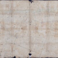
An undated sectional map showing public lands and private claims in coastal Volusia County, Florida, from Bulow Creek south to Mosquito Bar. The map includes the Atlantic Ocean, Halifax River, an inlet with sandbars and islands, Tomoka Creek, and the…
First Annual 250 Mile Stock Car Beach and Road Race, Daytona Beach, Florida
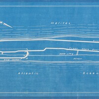
An official course map prepared by the City Engineering Department for the First Annual 250 Mile Stock Car Beach and Road Race at Daytona Beach, Florida, in March 1936. The map identifies the Atlantic Ocean, Halifax River, Port Orange Bridge, Ocean…
Map of Daytona and Surroundings, 1896
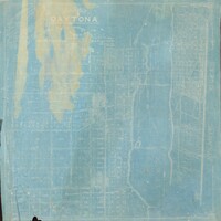
An 1896 map of Daytona and its surroundings in Volusia County, Florida, prepared by D. D. Rogers. The map covers the area from the Atlantic Ocean west to Fifth Street and from Mason Street south to Fremont Avenue. It shows three bridges across the…
Map of Daytona and Vicinity, Volusia County, Florida
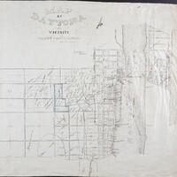
An undated map of Daytona and vicinity in Volusia County, Florida, prepared by D. D. Rogers. It depicts the Atlantic Ocean and Halifax River and identifies Pinewood Cemetery, a wagon bridge connecting Fairview and Seabreeze avenues, the Halifax Post…
Plat of Property Belonging to Jno. Anderson Situated at Ormond, Florida, 1904
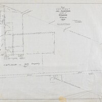
A 1904 plat of property belonging to John Anderson in Ormond, Florida, prepared by D. D. Rogers. The map shows the Halifax River shoreline, the U.S. Survey meander line, an arbor walk, drives and structures, Fire Trail Road, orange groves, a packing…
Report of Proposed System of Waterworks for the City of Daytona, Florida
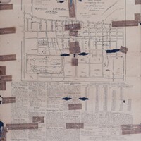
An April 1908 report and map outlining a proposed waterworks system for the City of Daytona, Florida. The mapped distribution system covers the area from Beach Street to Fourth Street and from Fremont Avenue to Arlington Avenue and identifies the…
Plot of D. D. Rogers Frontage on the Halifax River
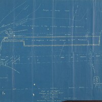
A detailed plot of D. D. Rogers's frontage on the Halifax River extending to Lot 5, Block 2 of Coleman's Addition to Daytona, Florida. The map documents Fairview Avenue, the Beach Street fill, the old shell bank, Coleman Road, Orange or Manley…
The Official Map of Holly Hill
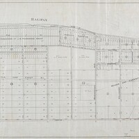
The official map of Holly Hill, Volusia County, Florida, compiled by D. D. Rogers and C. M. Rogers in May 1905. The map depicts the area from the Halifax River to Center Street and includes the Mason and Carswell Subdivision, Mason Avenue, North…
Map of Daytona and Vicinity

An undated map of Daytona and its vicinity in Volusia County, Florida, showing the Atlantic Ocean, Halifax River, two bridges, Bethune Point, and the surrounding street network from Mason Street to South Street and from the Halifax River west to…
Map of the Eastern Terminus of the B.S.O.C. and A. Ry. at New Smyrna
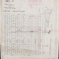
A map dating from approximately 1887 to 1888 of the eastern terminus of the B.S.O.C. and A. Railway at New Smyrna, Florida. The map identifies railroad facilities including the railroad wharf, depot, engine house, turntable, and repair shops, as well…