Browse Items (10 total)
- Tags: map
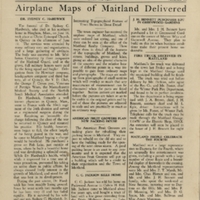
The Maitland News, Vol. 01, No. 10, July 10, 1926
Tags: A. S. Clark; Agnes Moreman; airplane; American Fruit Growers; Anna B. Treat; Augusta; bank; Bank of Maitland; banking; Billie White; book; Boy Scouts of America; C. C. Jackson; C. D. Horner; C. M. Niven, Jr.; C. N. Beecher; Calvin H. Hill; Campbell Thompson; Charles Horner; church; citrus; Dixie Highway; Donald G. Spain; Dorothy Williams; E. A. Upmeyer; E. B. Mendsen; E. T. Owen; education; Elsie Hamilton; Emilie Cass; Eva Thompson; F. T. Marsh; fire department; fire engine; Flora's Studio; George F. Cryan; Goodyear Tires; government; H. M. Thompson; Hill School; housing; J. A. Brown; J. H. Bennett; J. M. Brown; James Doig; Jesse Williams; John Nelson; Lake Sybelia; library; local government; Louis L. Coudert; Lucy Brown; M. L. Kyle; M. S. Archer; Maitland; Maitland Auxiliary; Maitland Electric Shop; Maitland Garage; Maitland Library; Maitland Lumber Company; Maitland Plumbing Company; Maitland Realty Company; map; Martha White; McNair; Methodist; Mount. Wollaston Cemetery; municipal government; National Guard; Presbyterian; real estate; Rollins College; S. B. Hill; S. J. Stiggins; school; Seldon White; Sydney C. Hardwick; Texaco Gas; The Maitland News; Town Council; Veterans of Foreign Wars; W. A. Manning; W. F. Parker; W. L. Parker; waterworks; White Way Motor Company
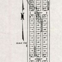
Map of Boston Hill Cemetery
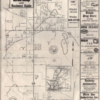
Oviedo Area Map and Business Guide
Tags: 1st Street; 2nd Street; 3rd Street; 4th Street; A. L. Yates, Jr.; Academy Street; Albert Cornelison; Albert's Jewelers; Allendale Drive; Altamonte Springs; art; Artesia Street; Ash Street; Audley Street; Auline Avenue; Austin Avenue; Avenue A; Avenue B; Avenue C; bank; banking industry; Bay Street; Beasley Road; Beech Street; Beverly Street; Big Tree; Bird Island; Bob Slaton; Boston Avenue; Boston Cemetery Road; Boston Street; Broadway Avenue; Broadway Street; Bumby View Drive; business; Cameron City; Canaan; Carib Lane; Carissa Lane; Carolyn Drive; Carver Avenue; Casselberry; Cedar Chest of Fashion Fabrics; Celery Avenue; Celery Circle; Central Avenue; ceramic; Chapel Street; Chapman Road; Ci Gi's; Citizens Bank of Oviedo; Citrus Avenue; Clark Street; Clonts Street; Colonial Drive; Crystal Avenue; Crystal Circle; Cypress Avenue; day care; Division Avenue; Dixie Gas Industries, Inc.; Doctor's Drive; Douglas Avenue; Downtown Oviedo; drug store; Eatonville; Eileen's Creative Mud Ceramics; Evans Street; Fairvilla; Faulk road; Fern Avenue; Fern Park; fertilizer; fertilizer industry; Field Street; First Street; Florida State Road 17-92; Florida State Road 415; Florida State Road 419; Florida State Road 420; Florida State Road 426; Florida State Road 431; Florida State Road 436; Florida State Road 46; Florida State Road 50; Florida Technological University; florist; Forest City; Forest Grove; Forest Trail; Fourth Street; Franklin Street; FTU; Gabriella; Garden Street; GE; General Electric; Geneva Drive; Goldenrod; Graham Avenue; H. P. Leu Botanical Gardens; Hamilton Avenue; hardware; Harrison Street; High Street; highway; hwardware industry; I-4; Interstate Highway 4; Italian; Jackson Street; Jamestown; jewelert; Kandel; Kimble Avenue; King Street; Kraft Azalea Gardens; Lake Charm; Lake Charm Circle; Lake Charm Drive; Lake Gem; Lake Hayes; Lake Hayes Road; Lake Jessup Avenue; Lake Mary; Lake Norma; Lake Road; Lake Rogers; Lake Rosa; Lawn Street; Lawton Avenue; Lee Avenuie; Lee Road; Lightwood Knot Canal; Lightwood Knot Creek; Lincoln Parkway; Lindsay Lane; Lingo Street; Little Econockhatchee Creek; Live Oak Lane; Long Lake; Longwood; Louise Avenue; Magnolia Street; Maitland; map; Maple Court; Mead Botanical Gardens; Mead Drive; meat; meat industry; Meat World; Middle Street; Midget City; Mimosa Trail; Mission Road; Mitchell Avenue; Mitchell Hammock Road; Muck Street; Myrtle Street; Naval Training Center Orlando; Nelson Hardware Store; Norma Avenue; Norwood Court; NTC Orlando; nursery; Nursery Street; Oak Circle; Oak Drive; Orange Avenue; Orangewood Drive; orlando; Orlando Sports Stadium; Orlando-Seminole Jai Alai Front; Oviedo; Oviedo Body and Paint Shop; Oviedo Child Care Center, Inc.; Oviedo Country Smoke House; Oviedo Drug Store; Oviedo Florists; Oviedo Saw and Mower; Oviedo Shopping Center; Palm Drive; Palm Way; Palmetto Street; Pemberton Street; Pembrple Avenue; Pennsylvania Avenue; pharmacy; Pine Avenue; Pine Street; Poulan; preschool; RCA; Red Bug Lake Road; Reed Road; restaurant; retail; Rich Drive; road; Rollings College; Rose Texaco; Round Lake; Ruth Street; Sanford; Sanford-Orlando Kennel Club; school; SCL; Seaboard Coast Line Railroad; Second Street; Shady Lane; Sharon Court; Slavia; Smith Street; Snapper; Southwood Court; SR 17-92; SR 415; SR 419; SR 420; SR 426; SR 431; SR 436; SR 46; SR 50; Stale Avenue; Stephen Avenue; street; Sweetwater Canal; Sylvan Lake; Tangerine Avenue; Taylor Street; Teleflora; television; Temple Terrace; Terrace Drivel Domer Street; Tesinsky Automotive; Third Street; Tomoka Drive; Tranquil Oaks Lane; True Value Hardware Stores; UCF; Union Park; University of Central Florida; Valenica Court; Vicki Vourt; Vine Street; Wagner; Washington Drive; Wekiwa Springs; Wheelco; Wheeler Fertilizer Company; Wilkerson Street; Willet Ad Maps; Winter Park; Wood Street; Woodcrest Circle
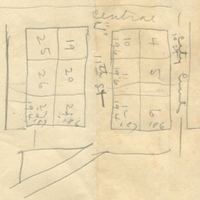
Map of Michael Gladden, Jr.'s Lots
Tags: Apopka; Gladden, Michael, Jr.; map; Mundy, Carol E.; Wall, Ella
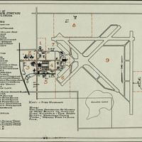
Zoning of U.S. Naval Air Station, Sanford, Florida
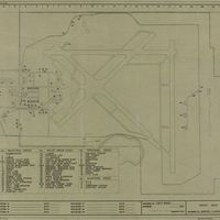
Index Map: Station N.A.S. Sanford, Florida
Naval Air Station Sanford Plat of Three Aviation Fields with Map of Seminole County
Tags: aviation; aviation field; Crippen Road; Geneva Avenue; Golden Lake; Lake Harney; Lake Jessup; Lake Monroe; map; Mellonville Avenue; NAS; NAS Sanford; Naval Air Station; Naval Air Station Sanford; Onoro Road; plat; Red Cleveland Boulevard; Seminole County; Silver Lake; Sipes Avenue; U.S. Navy; Williams, Fred T.; World War II; WWII
New York Giants Farm Clubs: Location of Ball Diamonds, Sanford, Florida
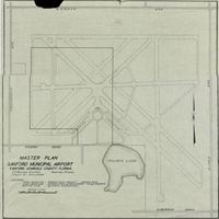
Master Plan, Sanford Municipal Airport, Sanford, Seminole County, Florida
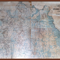
Map of Orange County, Florida, 1890
Tags: Apopka; Apopka Sawgrass; Big Sand Lake; cadastral map; Chuluota; Conway; E. W. Smith & Company; Fries, J. Otto; Gabriella; Glen Ethel; Gotha; Lake Apopka; Lake Charm; Lake Harney; Lake Jessup; Lake Monroe; Longwood; Maitland; map; McKinnon; Monroe; orange county; orlando; Oviedo; Palm Spring; Paola; Pine Castle; Plymouth; Sanford; Seminole County; surveyor map; Sylvan Lake; Upsala; Wilcox; Winter Park; Zellwood
