Browse Items (4936 total)
Sort by:
Letter from Joshua Coffin Chase to Sydney Octavius Chase (December 1, 1927)
An original letter of correspondence between brothers and business partners Joshua Coffin Chase and Sydney Octavius Chase. Topics discussed in the letter include the unsatisfactory piece system for packing at Isleworth Grove, insufficient wrapping…
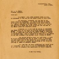
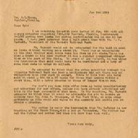
Letter from Joshua Chase to brother Sydney Chase (April 29, 1931)
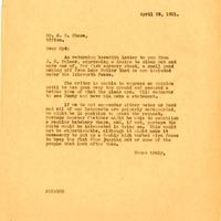
An original letter of correspondence between brothers and business partners Joshua Coffin Chase and Sydney Octavius Chase. Topics discussed in the letter include a letter to Sydney from J. C. Palmer and his inquiry to establish a fish nursery along…
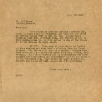
Letter from Joshua Coffin Chase to Sydney Octavius Chase (April 27, 1927)

An original letter of correspondence between brothers and business partners Joshua Coffin Chase and Sydney Octavius Chase. Topics discussed in the letter include an attached letter to C. E. Browne, a pipe leakage at Isleworth Grove and the need for…
Letter from Joshua Chase to brother Sydney Chase (April 16, 1929)
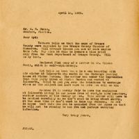
An original letter of correspondence between brothers and business partners Joshua Coffin Chase and Sydney Octavius Chase. Topics discussed in the letter include obtaining maps of Orange County from the Orange County Chamber of Commerce, obtaining…
Letter from Joshua Coffin Chase to Sydney Octavius Chase (April 15, 1911)
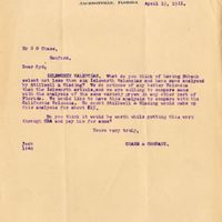
An original letter of correspondence between brothers and business partners Joshua Coffin Chase and Sydney Octavius Chase. Topics discussed in the letter include the analysis of Isleworth Valencias produced at Isleworth Grove, the comparison of said…
Letter from Joshua Coffin Chase to Sydney Octavius Chase (April 2, 1926)
An original letter of correspondence between brothers and business partners Joshua Coffin Chase and Sydney Octavius Chase. Topics discussed in the letter include the employment of A. Q. Lancaster,Chase & Company was established by brothers Sydney…
Letter from Joshua Coffin Chase to Sydney Octavius Chase (April 5, 1923)
An original letter of correspondence between brothers and business partners Joshua Coffin Chase and Sydney Octavius Chase. Topics discussed in the letter Joshua's recommendation to discontinue the Chase Brand of citrus in favor of the Isleworth…
Letter from Joshua Coffin Chase to Brockelman Brothers (January 30, 1928)
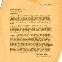
An original letter of correspondence between Joshua Coffin Chase and Brockelman Brothers, Inc. Topics discussed in the letter include the Brockelman magazine Broadcaster issue about Isleworth Grove, additional mention of the Isleworth oranges and…
Letter from Joshua Coffin Chase to Brockelman Brothers (January 20, 1928)
An original letter of correspondence between Joshua Coffin Chase and Brockelman Brothers, Inc. Topics discussed in the letter include the Isleworth Grove property, the 1894-1895 freeze, the varieties of citrus crops at the grove, the 1928 harvest,…
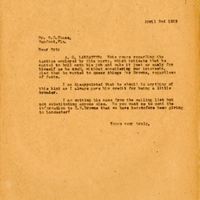
Letter from Joshua Coffin Chase to A. Q. Lancaster (March 31, 1923)
An original letter of correspondence between Joshua Coffin Chase and A. Q. Lancaster. Topics discussed include Lancaster's claim of unfair treatment from Chase's brother, Sydney Octavius Chase, and Lancaster's inability to work at Isleworth Grove due…
Letter from Joshua Coffin Chase to Sydney Octavius Chase (January 5, 1923)
An original letter of correspondence between brothers and business partners Joshua Coffin Chase and Sydney Octavius Chase. Topics discussed in the letter include a paving bond for property in Sanford and the offer made by B. H. Barnett.
Chase &…
Chase &…
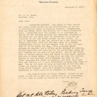
Letter from Joshua Coffin Chase to Sydney Octavius Chase (December 7, 1921)
An original letter of correspondence between brothers and business partners Joshua Coffin Chase and Sydney Octavius Chase. Topics discussed in the letter include copies of letters between Sydney, Cary D. Landis, and S. V. Stephens; a copy of Sydney's…
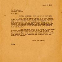
Letter from Joshua Coffin Coffin Chase to William Langford (March 27, 1922)
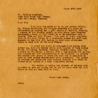
An original letter of correspondence between Joshua Coffin Chase and golf course engineer and landscaper William Langford. Topics discussed in the letter include Langford mapping a golf course for the Sanford Country Club and Golf Course.The Sanford…
Letter from Joshua Coffin Chase to Sydney Octavius Chase (October 25, 1923)
An original letter of correspondence between brothers and business partners Joshua Coffin Chase and Sydney Octavius Chase. Topics discussed in the letter include information that Lee Guest would send to Sydney in regards to the Municipal Golf course…
Letter from Joshua Coffin Chase to Sydney Octavius Chase (May 11, 1922)

An original letter of correspondence between brothers and business partners Joshua Coffin Chase and Sydney Octavius Chase. Topics discussed in the letter include the completion of the contract with Cameron Trent to develop the Sanford Country Club…
Letter from Joshua Coffin Chase to Sydney Octavius Chase (March 30, 1922)
An original letter of correspondence between brothers and business partners Joshua Coffin Chase and Sydney Octavius Chase. Topics discussed in the letter include the formation of the Sanford Country Club and Golf Course and the type of grass used at…
Letter from Joshua Coffin Chase to Sydney Octavius Chase (March 30, 1922)
An original letter of correspondence between brothers and business partners Joshua Coffin Chase and Sydney Octavius Chase. Topics discussed in the letter include the status of the Ingrahams and the St. Augustine Country Club.Chase & Company was…
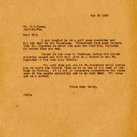
Letter from Joshua Coffin Chase to Sydney Octavius Chase (March 27, 1922)
An original letter of correspondence between brothers and business partners Joshua Coffin Chase and Sydney Octavius Chase. Topics discussed in the letter include golf course engineer and landscaper William Langford, the development of the course at…
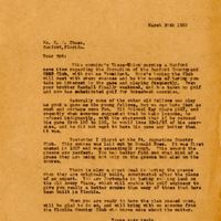
Letter from Joshua Coffin Chase to Sydney Octavius Chase (March 15, 1922)
An original letter of correspondence between brothers and business partners Joshua Coffin Chase and Sydney Octavius Chase. Topics discussed in the letter include the expected arrival of a golf expert to lay out the course of the new country club.The…
Letter from Joshua Coffin Chase to A. M. Taylor (April 1, 1922)

An original letter of correspondence between Joshua Coffin Chase and A. M. Taylor. Topics discussed in the letter include Chase's gratitude for his visit with Mr. Wilson to the St. Augustine Country Club and Chase's brother, Sydney Octavius Chase's…
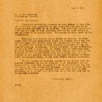
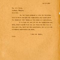
Letter from Joshua Coffin Chase to Sydney Octavius Chase (October 19, 1934)
An original letter of correspondence written by Joshua Coffin Chase to his father and Chase & Company business partner, Sydney Octavius Chase. The letter discusses a meeting Joshua attended in Lakeland about the specifics on the proposed Federal…
Letter from Joshua Chase to Sydney Chase (October 19, 1934)

An original letter of correspondence written by Joshua Chase to his father and Chase & Company business partner Sydney Chase. The letter discusses a meeting Joshua attended in Lakeland about the specifics on the proposed Federal Marketing Agreement…
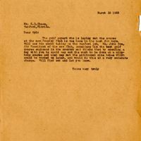
Chase & Company Invoice (June 12, 1962)
Invoice from Chase & Company paying $153.55 to Pilgrim Black (1905-2002), the father of Patricia Black, for the use of his vehicles for hauling products or equipment for the week ending June 12, 1962. Pilgrim Black was born in 1905, although some…
Chase & Company Invoice (April 19, 1962)
Invoice from Chase & Company paying $86.66 to Pilgrim Black (1905-2002), the father of Patricia Black, for the use of his vehicles for hauling products or equipment for the week ending April 19, 1962. Pilgrim Black was born in 1905, although some…
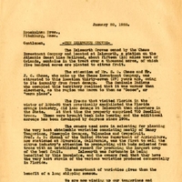
Memorandum by Chase & Company (April 8, 1924)
An original memorandum written by representatives from Chase & Company. The memo highlights issues that the Florida Citrus Exchange experienced during the 1923-1924 season, including competition between the citrus industries in California and…
Memorandum by Chase & Company (April 8, 1924)

An original memorandum written by representatives from Chase & Company. The memo highlights issues that the Florida Citrus Exchange experienced during the 1923-1924 season, including competition between the citrus industries in California and…
Original Orange Seedling at Belair Grove
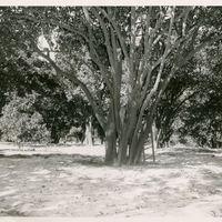
Original orange seedling planted by Henry Sanford at Belair Grove. In 1870, Henry Shelton Sanford purchased 23 square acres of land known as the Sanford Grant. The acreage included an experiment station called Belair located just three miles…
Randall Chase at Belair Grove
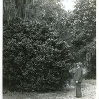
Randall Chase, son of Sydney Chase, examining a camellia bush at Belair Grove. In 1870, Henry Shelton Sanford purchased 23 square acres of land known as the Sanford Grant. The acreage included an experiment station called Belair located just three…
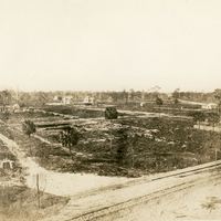
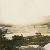
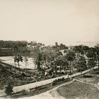
Belair Grove After Freeze
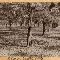
Belair Grove after the Freeze of 1894-1895.In 1870, Henry Shelton Sanford purchased 12,547.15 square acres of land known as the Sanford Grant. The acreage included an experiment station called Belair Grove, located just three miles southwest of the…
Belair Lodge
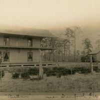
The Belair home of Henry Sanford and family sometime before 1925. In 1870, Henry Shelton Sanford purchased 23 square acres of land known as the Sanford Grant. The acreage included an experiment station called Belair located just three miles southwest…
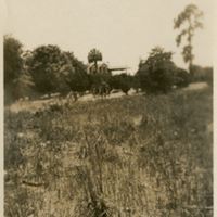
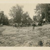
Men Clearing Land at Hole 3 Fairway
Workers are seen clearing land from the position of the tee at the Sanford Country Club and Golf Course in 1922. The land for the club and course was originally purchased as a portion of a 20,000-acre tract by General Joseph Finegan for $40. In 1870,…
Hole 9 Looking Towards Green From Center of Fairway
Center of the fairway facing the direction of the green at the Sanford Country Club and Golf Course in 1922. The land for the club and course was originally purchased as a portion of a 20,000-acre tract by General Joseph Finegan for $40. In 1870,…
Hole 7 at Bend Looking Towards Tee
The bend facing the direction of the tee at the Sanford Country Club and Golf Course in 1922. The land for the club and course was originally purchased as a portion of a 20,000-acre tract by General Joseph Finegan for $40. In 1870, Henry Sanford…
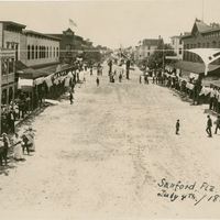
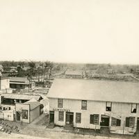
Fourth of July Celebration Along Commercial Street in Sanford
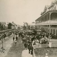
Fourth of July celebrations along Commercial Street in 1886. The large building on the right is the Sanford House Hotel, which was built by Henry Sanford (1823-1891) with the intent of attracting tourists and providing housing for would-be wealthy…
Steamer Osceola at Dock in Sanford
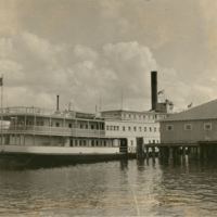
Steamship Osceola at a dock in Sanford sometime between 1913 and 1928. The steamer was built in 1913 at Jacksonville's Merill Stevens Shipyard for the Clyde Line Steamboat Company. The ship was captained by T.W. Lund and ran between Jacksonville and…
The Hole #5 Fairway at the Sanford Country Club
Construction of Hole #5 at the Sanford Country Club and Golf Course sometime during 1922 and 1924. The land for the course was originally purchased as a portion of a 20,000-acre tract by General Joseph Finegan for $40. In 1870, Henry Sanford…
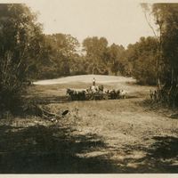
Workmen Clear Hole #4 Green
Workmen clearing Hole #4 green at the Sanford Country Club using teams of horses and shovels. Sanford Country Club and Golf Course was originally purchased as a portion of a 20,000-acre tract by General Joseph Finegan for $40. In 1870, Henry Sanford…
Flagpole and Green at Sanford Country Club
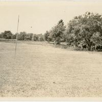
Flagpole and green at the Sanford Country Club and Golf Course during construction in 1922. The land for the club and course was originally purchased as a portion of a 20,000-acre tract by General Joseph Finegan for $40. In 1870, Henry Sanford…
Looking Southwest from First Street and Palmetto Avenue
Looking southwest from the intersection of East First Street and North Palmetto Avenue in Sanford, Florida in 1882. When Henry Shelton Sanford purchased land in central Florida, he developed citrus groves known as the Belair Groves and Experimental…
First Street Looking West from Sanford Avenue on the 4th of July
In 1870, a lawyer from Connecticut by the name of Henry Sanford purchased 12,548 acres of open land west of Mellonville. His vision was to make this new land a major port city, both railway and by water. Sitting on Lake Monroe, and the head of the…
Burning $1,572,650 Worth of Cancelled Bonds
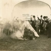
The burning of canceled bonds from Mayor Forrest Lake's (1869-1939) on January 5, 1932. Before this scandal surfaced, Lake was considered an accomplished politician, who was elected eleven times, and helped create Seminole County. However, the pace…
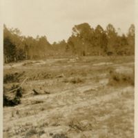
#9 Looking Towards Tee
Construction of the golf course at the Sanford Country Club and Golf Course in Sanford, Florida sometime between 1919 and 1924. The land was originally purchased as a portion of a 20,000-acre tract by General Joseph Finegan for $40. In 1870, Henry…
Cypress 2800 Years Old
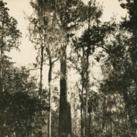
The giant bald cypress tree known as The Senator during the first quarter of the 20th century. As early as the late 1800s, this centuries-old tree was considered a tourist destination, but it wasn't until 1927 that a park was established around the…
Dock in Sanford
A dock in Sanford, Florida in 1934. Sanford's location on the shore of Lake Monroe played a significant role in the growth of the city as a commercial hub. Lake Monroe is a part of the St. Johns River which served as a commercial highway through…
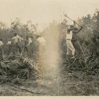
Fumigating Citrus Trees
Agricultural laborers fumigating citrus trees at Isleworth Grove in Windermere, Florida in 1904. Chase & Company was established by Joshua Chase and his brother Sydney in 1884. The company sold insurance and later invested in storage facilities and…
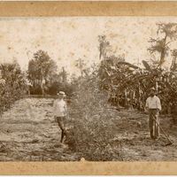
Three Citrus Workers
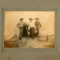
Three citrus workers at Isleworth Grove in Windermere, Florida in 1904. Chase & Company was established by Joshua Chase and his brother Sydney in 1884. The company sold insurance and later invested in storage facilities and fertilizer sales. Chase &…
One Year Buds in Nursery
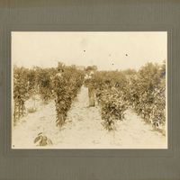
One year old citrus buds at Isleworth Grove in Windermere, Florida in 1904. Chase & Company was established by Joshua Chase and his brother Sydney in 1884. The company sold insurance and later invested in storage facilities and fertilizer sales.…
Aerial Views of Isleworth Grove
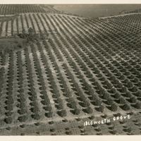
Aerial views of Isleworth Grove in Windermere, Florida in 1936. Chase & Company was established by Joshua Chase and his brother Sydney in 1884. The company sold insurance and later invested in storage facilities and fertilizer sales. Chase & Company…
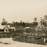
Church of the Holy Cross
The Holy Cross Episcopal Church, located at 410 South Magnolia Avenue in Sanford, Florida in 1880. Gertrude Dupuy Sanford, the wife of General Henry S. Sanford (1823-1891), established the Holy Cross Episcopal Church in 1873. The church was…
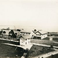
Sanford House Hotel Park
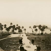
The Sanford House Hotel Park, adjoining the Sanford House Hotel, overlooked the waterfront of Lake Monroe at Commercial Street and Palmetto Avenue in Sanford, Florida in 1934. The hotel was built by Henry Sanford (1823-1891) with the intent of…
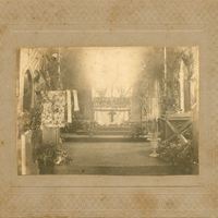
Easter at Holy Cross Episcopal Church
The Holy Cross Episcopal Church, located at 410 South Magnolia Avenue in Sanford, Florida during Easter of 1901. Gertrude Dupuy Sanford, the wife of General Henry S. Sanford (1823-1891), established the Holy Cross Episcopal Church in 1873. The church…
Church of the Holy Cross Destroyed in Hurricane of 1880
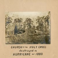
The Holy Cross Episcopal Church, located at 410 South Magnolia Avenue in Sanford, Florida after the Hurricane of 1880. On August 29, 1880, a Category 2 hurricane made landfall near Saint Augustine, affecting areas from the Jupiter Inlet to the mouth…
Holy Cross Episcopal Church
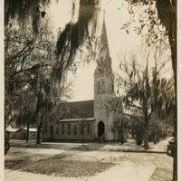
The Holy Cross Episcopal Church, located at 410 South Magnolia Avenue in Sanford, Florida. Gertrude Dupuy Sanford, the wife of General Henry S. Sanford (1823-1891), established the Holy Cross Episcopal Church in 1873. The church was consecrated on…
Church of the Holy Cross
The Holy Cross Episcopal Church, located at 410 South Magnolia Avenue in Sanford, Florida in 1880. Gertrude Dupuy Sanford, the wife of General Henry S. Sanford (1823-1891), established the Holy Cross Episcopal Church in 1873. The church was…
Intersection at Second Street and Oak Street
The intersection of Second Street and Oak Street in Sanford, Florida in 1884. When General Henry Shelton Sanford (1823-1891) first established the City of Sanford, he laid out the streets on a grid plan. Streets running toward Lake Monroe were given…
Sanford After Great Fire
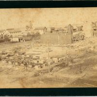
Sanford, Florida after the Great Fire of 1887. On September 27, 1887, "The Big Fire" burned and damaged the majority of the east side of Sanford. The fire began at Altree's Bakery on First Street and quickly spread through the wooden buildings in…
Sanford After Great Fire of 1887
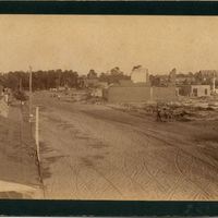
Sanford, Florida after the Great Fire of 1887. On September 27, 1887, "The Big Fire" burned and damaged the majority of the east side of Sanford. The fire began at Altree's Bakery on First Street and quickly spread through the wooden buildings in…
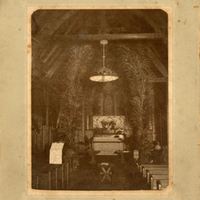
Interior View of Holy Cross Episcopal Church
The Holy Cross Episcopal Church, located at 410 South Magnolia Avenue in Sanford, Florida. The photograph was likely taken before the building burned down in November of 1923.
Gertrude Dupuy Sanford, the wife of General Henry S. Sanford…
Gertrude Dupuy Sanford, the wife of General Henry S. Sanford…
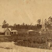
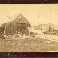
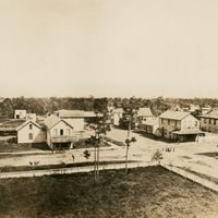
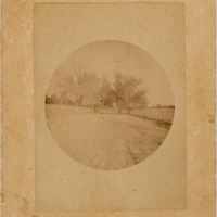
Orange Grove After the Freeze of 1888
Orange grove in Sanford, Florida. By the time that this photograph had been taken in 1897, citrus groves in Central Florida had mostly recover from the devastating Freeze of 1888.
In 1871, General Henry S. Sanford (1823-1891) began clearing land…
In 1871, General Henry S. Sanford (1823-1891) began clearing land…
Old Fort Reid Building
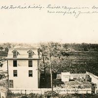
Former building at First Street and Magnolia Avenue prior to the construction of the N.P. Yowell and Garner Woodruff Buildings. The building was named after Fort Reid, which was established by Colonel William Harney on July 7, 1840. Colonel Harney…
First Street and Park Avenue
The intersection of First Street and Park Avenue in Sanford, Florida in 1882. When General Henry S. Sanford (1823-1891) first established the City of Sanford, he laid out the streets on a grid plan. Streets running toward Lake Monroe were given names…
Sanford House Hotel Park
The Sanford Hotel House Park in Sanford, Florida in 1880. The Sanford House Hotel was built by Henry Sanford (1823-1891) with the intent of attracting tourists and providing housing for would-be wealthy settlers to the city of Sanford. The Sanford…
First Street Between Palmetto Avenue and Magnolia Avenue
First Street between Palmetto Avenue and Magnolia Avenue in Sanford, Florida in 1882. When General Henry S. Sanford (1823-1891) first established the City of Sanford, he laid out the streets on a grid plan. Streets running toward Lake Monroe were…
Palmetto Avenue and First Street
When General Henry S. Sanford (1823-1891) first established the City of Sanford, Florida, he laid out the streets on a grid plan. Streets running toward Lake Monroe were given names of native Florida trees, while streets running parallel to the lake…
Live Oaks Along Mellonville Avenue
Live oak trees along Mellonville Avenue in the early 1900s. In 1836, the United States Army built a road (present-day Mellonville Avenue) to a location called Camp Monroe during the Second Seminole War. One year later, a group of Seminoles attacked…
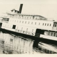
Back of Steamship Osceola
Backside of Steamship Osceola, which was built in 1913 at Jacksonville's Merill Stevens Shipyard for the Clyde Line Steamboat Company. The ship was captained by T.W. Lund and ran between Jacksonville and Sanford (a 140 mile trip) and could carry 60…
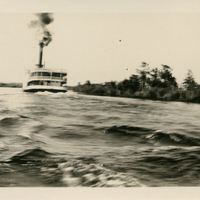
Steamship Osceola
Steamship Osceola along the St. Johns River near Sanford, Florida in the early 1900s. Osceola was built in 1913 at Jacksonville's Merill Stevens Shipyard for the Clyde Line Steamboat Company. The ship was captained by T.W. Lund and ran between…
Water Hyacinths Near Sanford
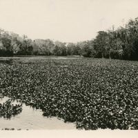
Water hyacinths on the St. Johns River near Sanford, Florida in the early 1900s. By the mid-1880s, Sanford, Florida had become a major distribution center due to the city's strategic location along Lake Monroe and the St. Johns River. Even before…
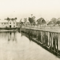
Boat Dock Near Sanford
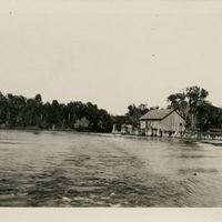
Boat dock near Sanford, Florida. By the mid-1880s, Sanford had become a major distribution center due to the city's strategic location along Lake Monroe and the St. Johns River. Even before Florida obtained statehood, steamboats frequented the St.…
Charleston, S.C.: America's Most Historic City Postcard
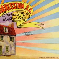
A postcard depicting Pink House in the French Quarter of Charleston, South Carolina. This historic house was constructed with pink Bermuda stone between 1694 and 1712. The structure was used as a tavern in the 1750s, a house in the 1780s, an art…
Cypress Gardens, Semi-Tropical Wonderland Postcard
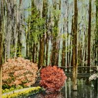
A postcard depicting Cypress Gardens in Moncks Corner, South Carolina. The land was originally part of the Dean Hall rice plantation in 1750. During the Great Depression, after years of disuse, Benjamin Kittredge opened the property to the public as…
Aerial View of Cooper River Bridge Postcard
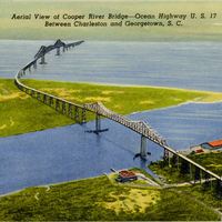
A postcard depicting an aerial view of the Cooper River Bridge and Ocean Highway in Charleston, South Carolina. Officially known as the John P. Grace Memorial Bridge, the bridge opened in 1929 to cross the Cooper River. The Cooper River Bridge was…
Views of the Citadel, The Military College of South Carolina Postcard
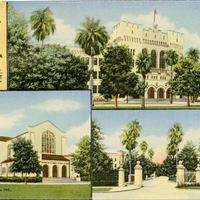
A postcard depicting The Citadel, The Military College of South Carolina in Charleston. Built in 1820, the original citadel stood on what is now Marion Square. In 1842, Governor John Peter Richardson III (1831-1899) called for the conversion of The…
Point of Battery and Statue, Showing Junction of Ashley and Cooper Rivers Postcard
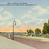
A postcard depicting The Battery at the junction of Ashley River and Cooper River in Charleston, South Carolina. The Battery is a defensive seawall and promenade named for a Civil War-era defense artillery battery located at the site.This postcard is…
Rainbow Row Postcard
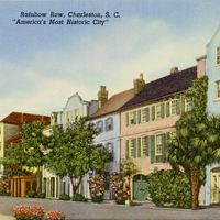
A postcard depicting Rainbow Row, a series of 13 historic houses in Charleston, South Carolina. During the 1930s and the 1940s, the houses were painted pastel colors, coining the name Rainbow Row.This postcard is part of a collection of postcards…
Famous Middleton Oak, Middle Gardens Postcard
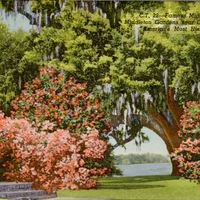
A postcard depicting the famous Middleton Oak tree at Middleton Gardens in Dorchester County, near Charleston, South Carolina. Now called Middleton Place, the site was formerly a plantation owned by a series of planters.This postcard is part of a…
Moonlight Scene on Battery Postcard
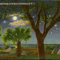
A postcard depicting The Battery in Charleston, South Carolina. The Battery is a defensive seawall and promenade named for a Civil War-era defense artillery battery located at the site.This postcard is part of a collection of postcards kept by Lucile…
Gateway of Simonton House Postcard
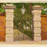
A postcard depicting the sword gate at the Simonton House in Charleston, South Carolina. While the gateway was added between 1815 and 1820, the house itself was built in 1776This postcard is part of a collection of postcards kept by Lucile Campbell,…
Typical Charleston Home Postcard
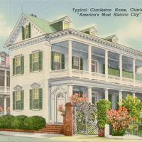
A postcard depicting a typical home in in Charleston, South Carolina. This postcard is part of a collection of postcards kept by Lucile Campbell, a schoolteacher in Sanford, Florida, for 30 years. In 1931, she took advantage of a special rate for…
Corner of Four Laws Postcard
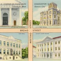
A postcard depicting showing the Corner of Four Laws at the intersection of Broad Street and Meeting Street in Charleston, South Carolina. At the intersection are four historic sites: St. Michael's Episcopal Church, the U.S. Post Office and…
Old Powder Magazine During Revolutionary War Postcard
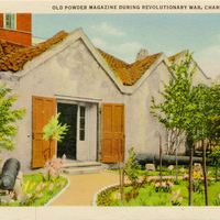
A postcard depicting the Powder Magazine in Charleston, South Carolina. This structure was constructed in 1713 to store gunpowder during the American Revolutionary War. The Powder Magazine now serves as a museum located at 79 Cumberland Street.This…
Exchange Building Postcard
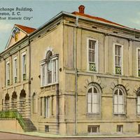
A postcard depicting the Exchange Building in Charleston, South Carolina. Also known as the Old Exchange and Provost Dungeon, the Custom House, and The Exchange, this structure was constructed from 1767 to 1671 and served a variety of civic…
Cooper River Bridge Postcard
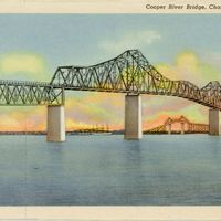
A postcard depicting the Cooper River Bridge in Charleston, South Carolina. Officially known as the John P. Grace Memorial Bridge, the bridge opened in 1929 to cross the Cooper River. The Cooper River Bridge was closed in 2005 and replaced by the…
Charleston Harbor Postcard
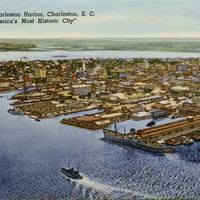
A postcard depicting Charleston Harbor in Charleston, South Carolina. The harbor was the site of two major Civil War events: the Battle of Fort Sumter and the attack on the USS Housatonic, a Union warship, by the H. L. Hunley, a Confederate…
Scene in Hampton Park Postcard
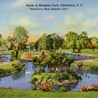
A postcard depicting a view of the Sunken Gardens, which were built in 1901 for the Inter-State and West Indian Exposition, a business fair. After the fair was over, Charleston, South Carolina, established Hampton Park, where the Sunken Gardens…
Beauty Spot, Magnolia Gardens Postcard
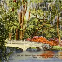
A postcard depicting Magnolia Plantation and Gardens near Charleston, South Carolina. Magnolia Gardens, which introduced hundreds of varieties of the plant to the United States, has an extensive collection of camellia plants, and continues to…
Murray Boulevard, Showing Fort Sumter Hotel and Docks Postcard
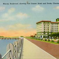
A postcard depicting a view down Murray Boulevard in Charleston, South Carolina, with Fort Sumter Hotel on one side and the docks on the other. Fort Sumter Hotel was built in 1923 and was converted into condominiums in the 1980s.This postcard is part…
The Old Market Postcard
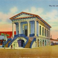
A postcard depicting the Old Market in Charleston, South Carolina. Originally called the Centre Market, market was established in the 1790s and is now known as the City Market. The market and its surrounding district was added to the U.S. National…
SheiKra at Busch Gardens Tampa, 2010
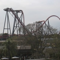
SheiKra, a roller coaster at Busch Gardens Tampa, a theme park located in Tampa, Florida, in 2010. SheiKra is a roller coaster that was added to the Stanleyville area of the park. Mark Rose, vice-president of design and engineering, proposed the idea…
Nairobi Train Station of the Serengeti Express Railway at Busch Gardens Tampa, 2010
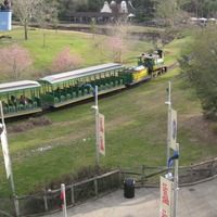
The Nairobi Train Station of the Serengeti Express Railway of Busch Gardens Tampa, a theme park located in Tampa, Florida, in 2010. The park opened as a hospitality facility for Anheuser-Busch Companies, Inc. on March 31, 1959. Busch…
Elephants at the Edge of Africa at Busch Gardens Tampa, 2010
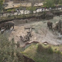
Elephants at the Edge of Africa of Busch Gardens Tampa, a theme park located in Tampa, Florida, in 2010. The park opened as a hospitality facility for Anheuser-Busch Companies, Inc. on March 31, 1959. Busch Gardens originally hosted a brewery with…
Zebras at the Edge of Africa at Busch Gardens Tampa, 2010
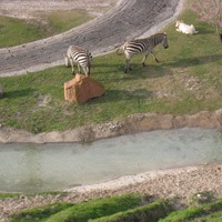
Zebras at the Edge of Africa of Busch Gardens Tampa, a theme park located in Tampa, Florida, in 2010. The park opened as a hospitality facility for Anheuser-Busch Companies, Inc. on March 31, 1959. Busch Gardens originally hosted a brewery with beer…
Bird Gardens at Busch Gardens Tampa, 2010
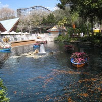
The Bird Gardens of Busch Gardens Tampa, a theme park located in Tampa, Florida, in 2010. Garden Gate Cafcan bee seen to the left of the photograph, and Gwazi, a roller coaster that opened in 1999, can be seen in the distance.Busch Gardens opened as…
Flamingos at Busch Gardens Tampa's Bird Gardens, 2010
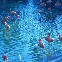
Flamingos at the Bird Gardens of Busch Gardens Tampa, a theme park located in Tampa, Florida, in 2010. The park opened as a hospitality facility for Anheuser-Busch Companies, Inc. on March 31, 1959. Busch Gardens originally hosted a brewery with beer…
Hurricane Charley Aftermath in Oviedo
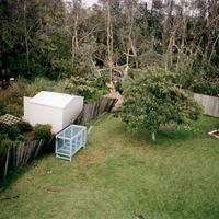
The aftermath of Hurricane Charley in Oviedo, Florida. Hurricane Charley formed on August 9, 2004, and dissipated on August 15. Charley was a Category 4 hurricane that made landfall in southwest Florida and was the strongest hurricane to hit the…
Adventureland at Magic Kingdom, 1974
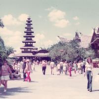
Nancy Lynn Cepero (b. 1954), on the right, at Adventureland at Magic Kingdom in 1974. Magic Kingdom, located at 1180 Seven Seas Drive, is a theme park at the Walt Disney World Resort in Lake Buena Vista, Florida. Construction for the resort began in…
Tom Sawyer Island at Magic Kingdom, 1974
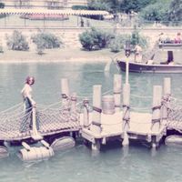
Nancy Lynn Cepero (b. 1954) walking across the bridge at Tom Sawyer Island at Magic Kingdom in 1974.Magic Kingdom, located at 1180 Seven Seas Drive, is a theme park at the Walt Disney World Resort in Lake Buena Vista, Florida. Construction for the…
Ormond Beach, 2014
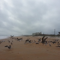
A variety of birds at Ormond Beach, Florida, in 2014. Some of the species of birds shown in the images include gulls, terns, sanderlings, dowitchers, and willets. Ormond Beach is a city located in Volusia County, just north of Daytona Beach. Timucuan…
Sunrise at Ormond Beach, 2012
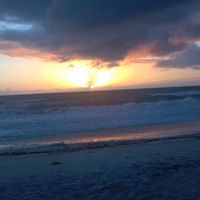
Sunrise at Ormond Beach, Florida, in 2012. Ormond Beach is a city located in Volusia County, just north of Daytona Beach. Timucuan Indians frequented the area, but it was not settled until 1643, when a group of Quakers arrived after being blown off…
Ormond Beach, 2012
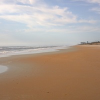
Ormond Beach, Florida, in 2012. Ormond Beach is a city located in Volusia County, just north of Daytona Beach. Timucuan Indians frequented the area, but it was not settled until 1643, when a group of Quakers arrived after being blown off course.…